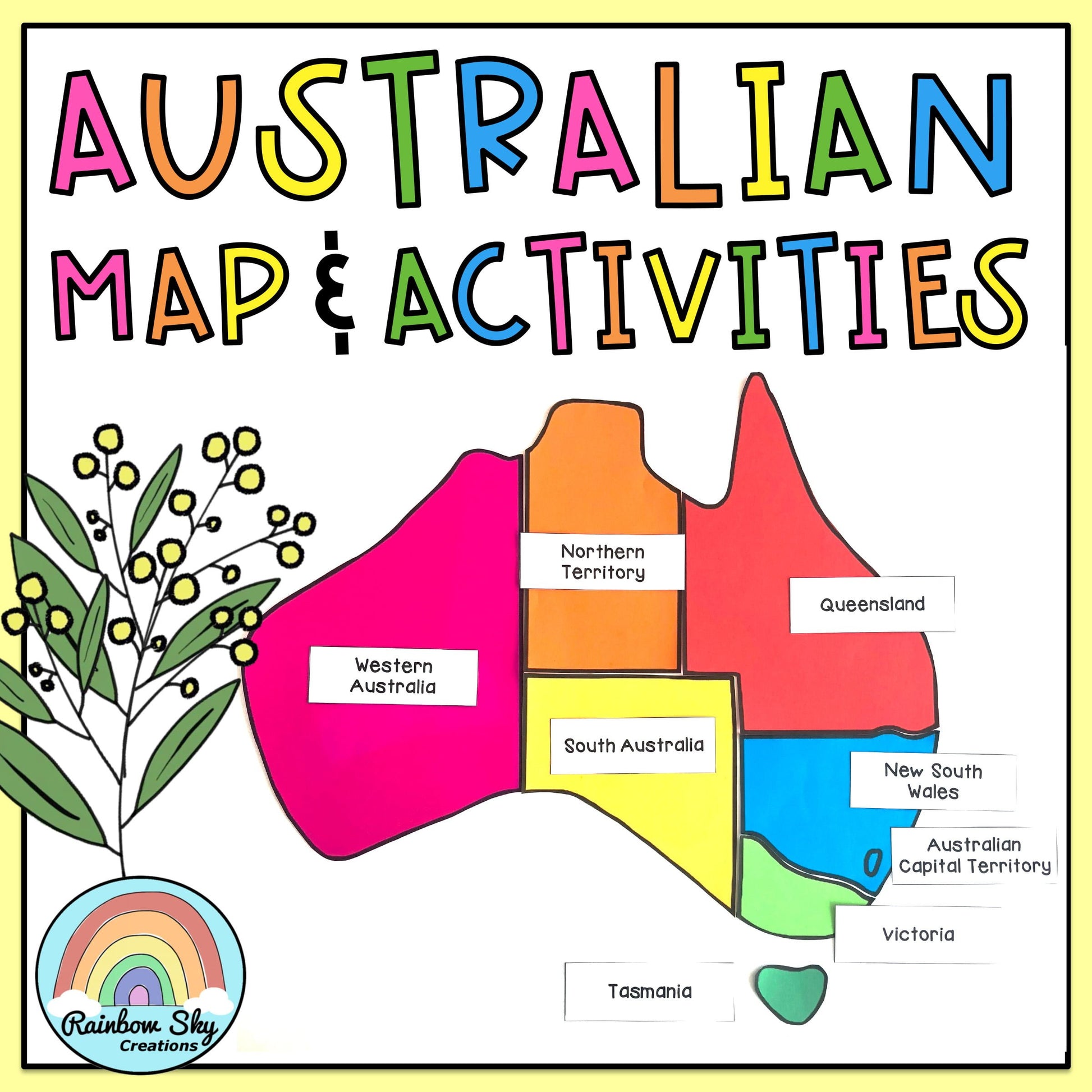

Australian Map Display & Geography Activities
Australian Map Display & Geography Activities
- DIGITAL PRODUCT: Get instant access after purchase!
Couldn't load pickup availability
A hand-drawn map display of Australia plus activity worksheets to teach your students about Australia’s States, Territories and Capital Cities.
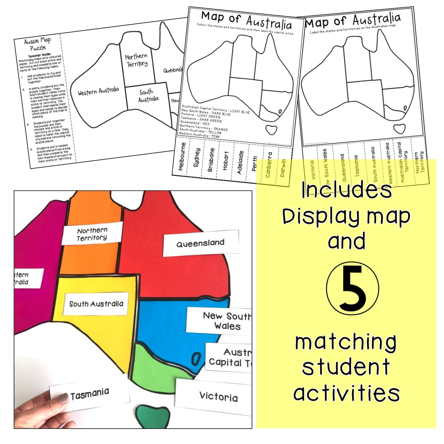
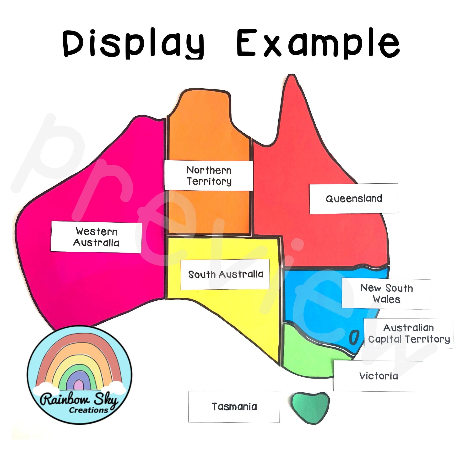
This pack includes a large hand-drawn map of Australia for your classroom wall. We have broken the states and territories up to one per page. They are all scaled to size. You can print as is (on A4 paper) or print and enlarge to A3 for a larger map.
Resource Activity List:
- Each Australian State and Territory scaled to size to put together as a display map
- State/Territory and Capital City labels
- Map of Australia – State and Territory labelling task
- Map of Australia – State & Territory colour code + capital city labelling task
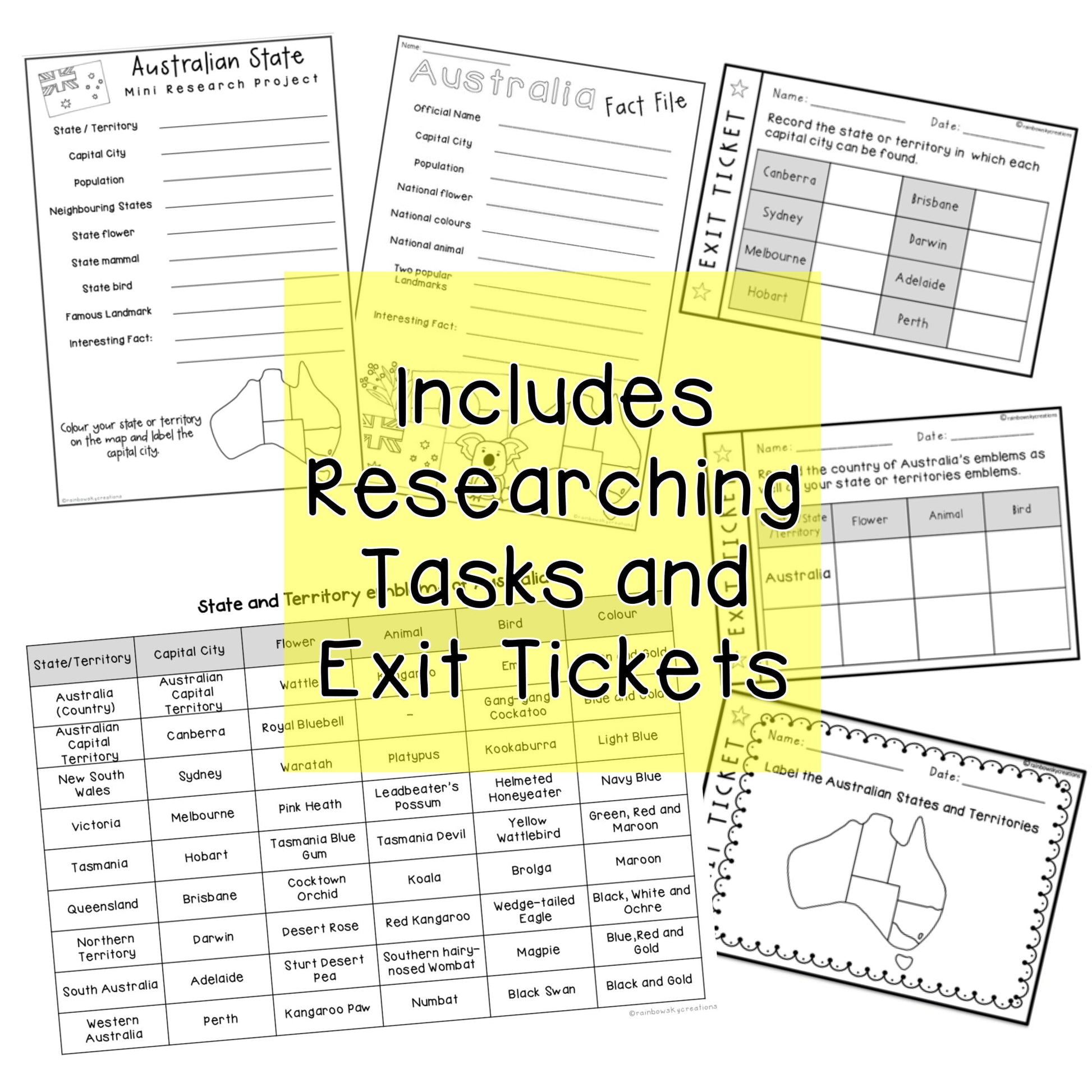
- Australia Fact File Task
- Australian State Mini Research Task
- Australian Map Puzzle Activities (4 activity variations)
- State and Territory emblems of Australia
- BONUS: Exit Tickets
Five activity pages are included to complement your lessons about Australia and its geography. There is a cut and paste activity, two researching tasks, as well as a hands-on, collaborative puzzle activity.
Provided is a table containing the state and territory emblems of Australia. This table could be used for students to challenge each other in recalling the facts or drawing/searching for the images of each emblem to add to the map. As a collaborative task allocate a state/territory to a group of students and have them find the image of each emblem to add to the class map.
Optional exit tickets are included to be used as a pretest or informal assessment.
Thanks for visiting!
********************************************
Share